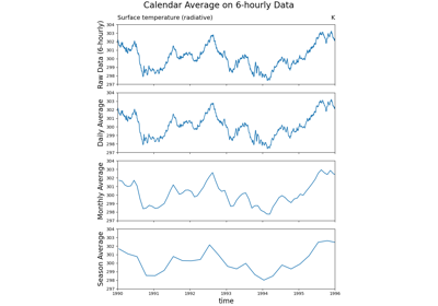
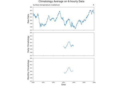
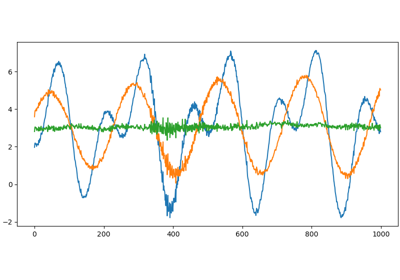
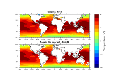
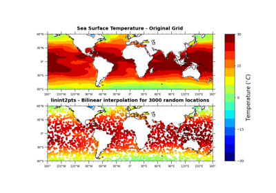
GeoCAT-comp Examples
This gallery contains usage examples for the GeoCAT-comp functions. These examples are represented as Python scripts and their corresponding Jupyter notebooks, which may or may not contain visualizations (i.e. Matplotlib plots), depending on the function characteristics.
For visualization, mainly matplotlib and cartopy are used. In addition, geocat-datafiles is used as a dataset storage and geocat-viz is used for a higher level implementation for low level matplotlib functionalitie. Xarray and numpy are used for data processing.
Click on any image to see the full image and source code as well as to download Python script and/or Jupyter notebook.